View of springs in Banias Nature Reserve (Yaakov Lederman/FLASH90)
A new mapping system shows that Syria placed the Banias plateau within Israel’s boundaries before the Six-Day War.
By World Israel News Staff
In what it calls an exclusive feature, the Israel Hayom daily reports that researchers at Tel-Hai College in northern Israel “discovered that prior to the 1967 Six-Day War, even Syria recognized that the Banias plateau – the site of a spring at the foot of Mount Hermon that feeds one of the main tributaries of the Jordan River – belonged to Israel.”
The newspaper notes that the discovery comes on the heels of U.S. President Donald Trump’s recognition of Israeli sovereignty over the Golan Heights, which the Jewish state captured during the 1967 Six-Day War.
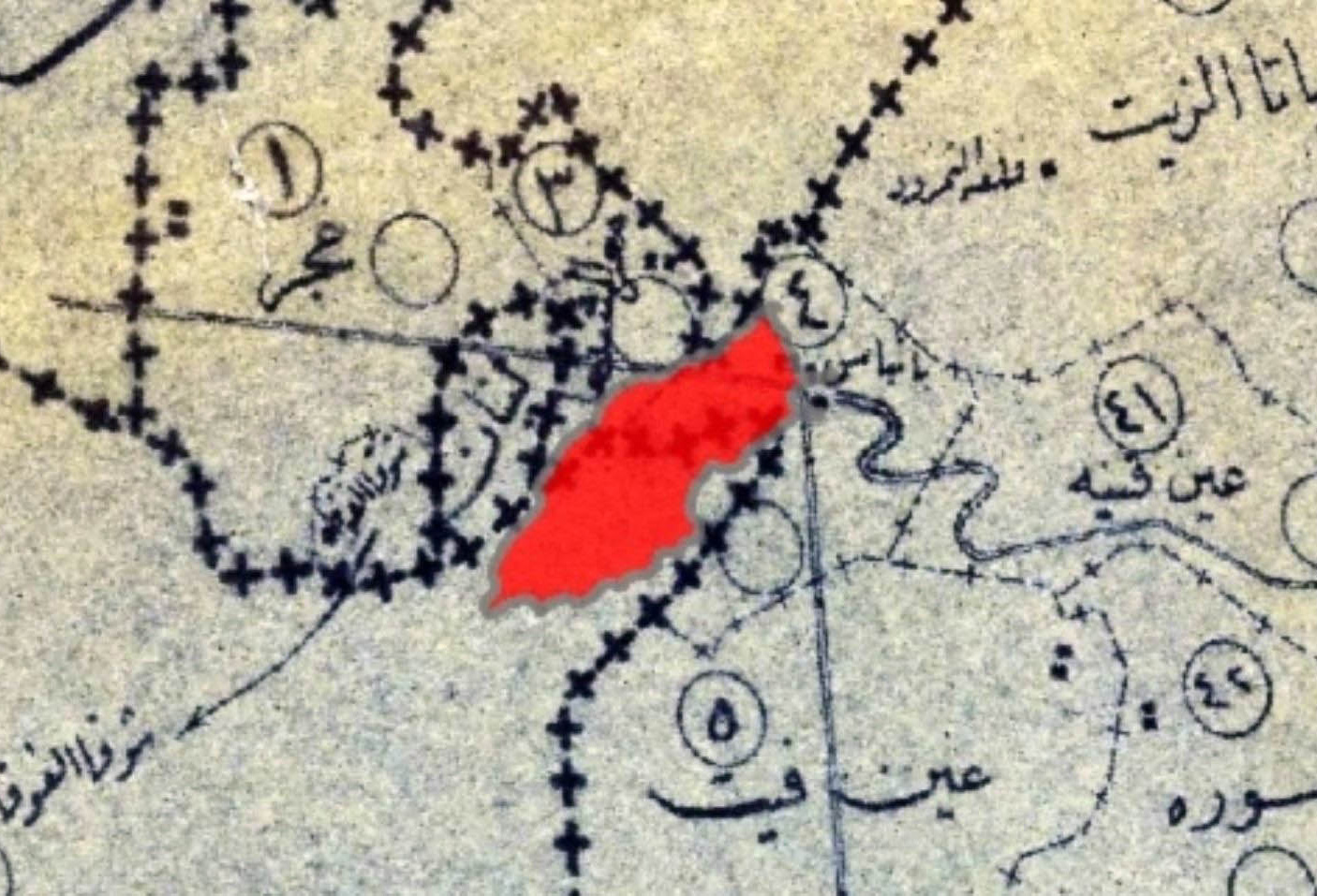
The researchers reportedly discovered a map from 1965 that was drawn by the Syrian planning and construction agency two years before the Six-Day War, which puts Banias on the Israeli side of the border, says Israel Hayom.
The paper quotes Shalom Tarmachi, head of the Tel-Hai College map collection, as giving context.
“In 1939, the Jewish National Fund purchased land in the area of Khan a-Duar at Banias, so the area belonged to Israel, both legally and politically,” says Tarmachi.
He notes that the 1949 armistice agreement which marked the official conclusion of Israel’s War of Independence classified the area in question as demilitarized “under the assumption that its status would be regulated in a future peace treaty,” says Israel Hayom.
The area in red marks land belonging to Israel but which Syria illegally occupied and used as a staging ground for attacks. (Tel Hai College)
Tarmachi adds, however, that until 1967, Israeli “communities in the Hula Valley suffered heavy Syrian fire from the Banias, and it became part of [Syria’s] attempt to divert the sources of the Jordan River.”
Israel Hayom cites the Tel-Hai mapping expert as saying that “before the college’s map archives began working with an advanced system that allows multiple maps to be overlaid on top of each other and adjusted to the same scale, it was very hard to identify to whom the Syrians assigned the territory in their maps.”
Now, he says, the new system makes it “very clear that the Syrians did not consider the demilitarized area as theirs, even though they used it for military activity.”
Yazouri had survived several previous Israeli attempts to kill him during the current war and…
The UAE normalized relations with Israel in 2020 under the Abraham Accords.
As Jews around the world prepare to welcome Rosh Hashana, we enter a new year…
Protesters argued that sanctions unfairly penalize Israeli settlers and civil society organizations instead of focusing…
Israel spent eight months luring Iran's top IRGC commanders into a trap, while covert operatives…
While Trump declined to order American strikes in Yemen, the US military has expanded its…