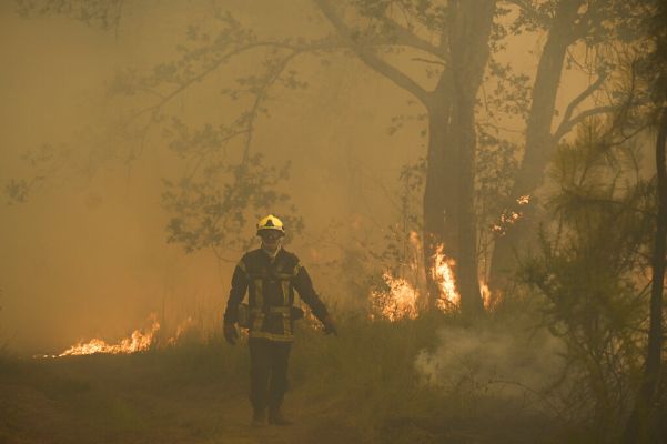
KKL-JNF estimates the ecosystem will require five to seven years to recover naturally.
The environmental impact of Hezbollah’s sustained attacks on northern Israel has reached catastrophic levels, with over 57,000 acres of land destroyed by fires.
According to the Keren Kayemeth LeIsrael-Jewish National Fund (KKL-JNF), the Upper Galilee and Golan Heights have borne the brunt of the destruction, with nearly 43,500 acres scorched.
The Lower Galilee lost approximately 6,175 acres, while the Western Galilee and Hula Valley suffered burns of 2,223 and 178 acres, respectively.
Particularly hard hit were the Birya and Baal Shem Tov forests near Safed, the Ramot Naftali Forest along the Lebanese border, and the Hazon Forest in the vicinity of Karmiel.
Wildlife populations have been severely impacted, with birds losing nesting sites and countless arthropods perishing in the flames.
The fires have also ravaged a diverse array of woodland species, from pine, cypress, and cedar to indigenous varieties like oak, Judas trees, and carob.
However, the damage extends beyond animal life and vegetation, with significant destruction to infrastructure including parking facilities, observation points, and scenic routes.
“Our foresters alongside the Israel Fire and Rescue Services are forced to work under extremely difficult conditions, under the constant threat of both the fires and the rockets,” stated KKL-JNF director Shelli Ben Yishai.
“Despite the enormous challenges, we continue to work around the clock to protect our forests, the people of the North, and its unique environment.”
KKL-JNF estimates the ecosystem will require five to seven years to recover naturally.
Since Oct. 7, 2023, the IDF estimates that approximately 10,000 Hezbollah rockets and suicide drones have been launched at the Jewish State.
To protect Israel’s ecosystem, the agency operates an advanced monitoring station equipped with aerial drones and sophisticated imaging technology, enabling rangers to spot and respond to fire threats before they spread even further.


